About the project
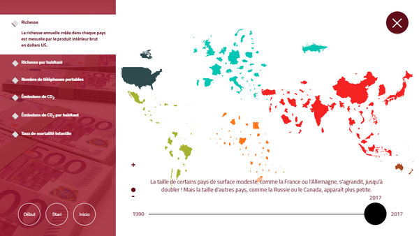
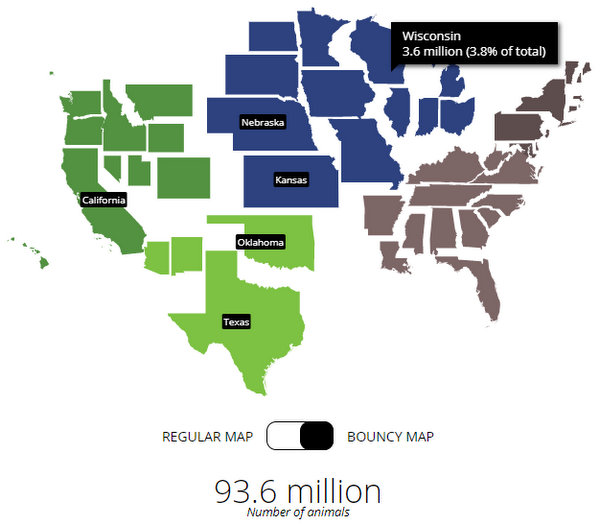
A map shows you how large countries are, in terms of area. Bouncy Maps, our cartogram feature, transform the map to show how large countries would be if another criterium were the key. Different countries will jump out. Because of their high visual impact, Bouncy Maps are an excellent presentation feature to highlight proportions in a fun way.
We can integrate our bouncy maps feature in your website or data product. Applied to the administrative areas of your choice: states, counties, neighboorhoods. As part of an interactive presentation or as an edited print map.